How the land heals — near Bileća, Bosnia and Herzegovina
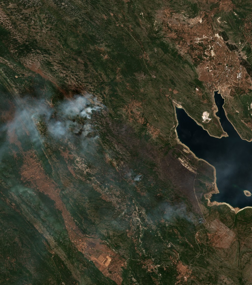
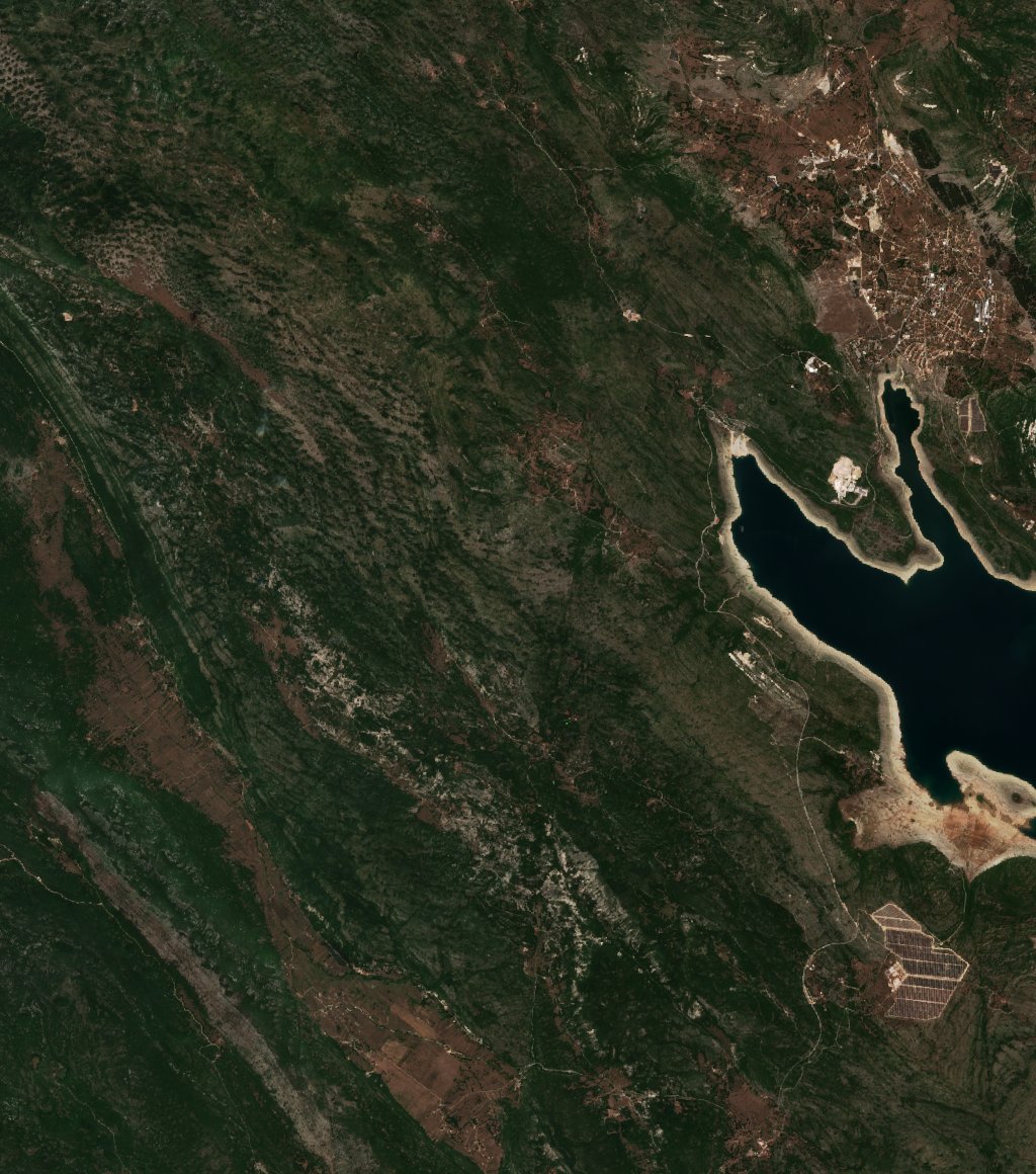
4066 hectares burned near Bileća, Bosnia and Herzegovina — the fire started on August 8, 2021. Below, one satellite image per year — always in the same season — shows how the vegetation returns. The detailed day-by-day image series is on the fire’s original case page van.
 2021
2026
2021
2026
Year by year
2021-08-12
2021
What does this series show? The first image was taken right after the fire
(August 12, 2021) — the dark patch is the fresh burn scar. Each following image was taken once a year, on the clearest day around the anniversary — so the seasonal colors are comparable. Where the patch gradually turns green again, vegetation is recovering; where it stays pale or grey after years, recovery is slower. The images come from the Sentinel-2 satellites — 6 yearly images.
Contains modified Copernicus Sentinel data 2021–2026 · satellite imagery: Copernicus Sentinel-2 · the fire’s day-by-day series · more recovery pages